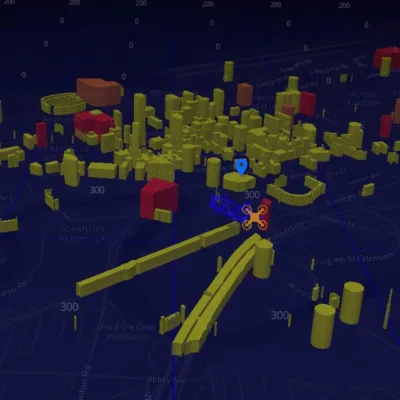
The NEOFIX project team is proud to announce the successful completion of a cutting-edge LiDAR scan of an 11-acre property near Guardians’ Bridge in Cleveland. Using a drone equipped with advanced Aerial Armor sensors, the team conducted an oblique scan from 300 feet above ground level (AGL) in just 38 minutes. This initiative provided high-resolution, real-time data critical for urban planning and public safety.
The scan location, situated along the river near the stadium, offers fresh insights to support future infrastructure projects and emergency response strategies. Through NEOFIX’s ability to stream live data, stakeholders can access continuous, actionable insights, driving smarter decisions in urban development and community planning.
Safety and compliance were enhanced by Remote ID technology, which enabled real-time tracking and identification of the drone during the flight. This feature ensured the airspace remained clear of conflicts and demonstrated a seamless integration of advanced safety measures with operational efficiency.
This achievement highlights NEOFIX’s commitment to advancing drone technology for public benefit and furthering the possibilities for smart city planning and public safety initiatives.
Be sure to visit our website regularly for more information on the NEOFIX project and its innovative solutions.
Soaring to new heights, together.
Be sure to visit the BWU Technology Partnerships Initiative website to learn more about how our NEOFIX program drives economic growth, promotes policy and infrastructure to improve drone safety and efficiency in various industries, and ensures that drone technology is being used responsibly.

